October 25, 2023 - Foliage Flight Cumberland, VA
|
| We're having beautiful fall weather this week so I decided to go flying on Wednesday. I figured the foliage color would be good in the Cumberland area so I headed west. In fact, the color was good at Essex Skypark early in the morning; here I am taxiing to the north end. |
| |
 |
|
|
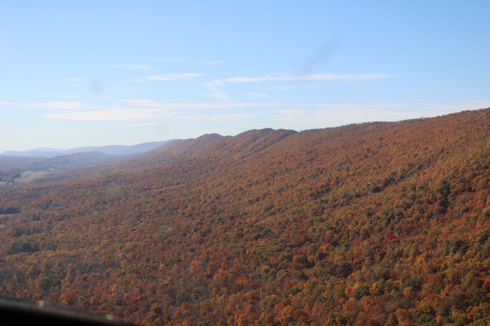
The big forested area east of Essex Skypark is always spectacular at peak. Won't be long now.
|
| |
 |
|
| Visibility was outstanding today. Look how sharp Baltimore is this morning. |
| |
 |
|
|
Cruising over Liberty Reservoir.
|
| |
 |
|
| Overhead Antietam Battlefield. You can see the Visitors Center right of center. Sharpsburg -- which the battle is sometimes called -- is at top center. |
| |
 |
|
| Looking down at Green Landings, a little grass strip airport community. |
| |
 |
|
| Now following the Potomac River west. |
| |
 |
|
|
Color looking pretty good.
|
| |
 |
|
| I-70 runs alongside the river for awhile. |
| |
 |
|
|
Approaching the little town of Hancock. Potomac Airpark is on the other side of the river.
|
| |
 |
|
|
A better shot of Hancock on the right. Just to the north of Hancock, I-70 turns north. But I-68 is born and continues west to Cumberland.
Hancock is an interesting town. The Chesapeake & Ohio Canal passes through the town. The railroad passes by on the south side of the river. The population was 1,557 at the 2020 census.
|
| |
 |
|
| The C&O Canal has been restored and preserved in this area; you can really see it in this close-up, to the right of the river. There is a hiking/bike trail alongside of the canal. |
| |
 |
|
| Looking back at Hancock and Potomac Airpark. Another good shot of the canal. They have drag races at the Airpark. |
| |
 |
|
|
Ahead, I-68 goes through the famous Sideling Hill Road Cut. It's very distinctive, especially when you are driving. On the way back today, I got some better pictures of it.
|
| |
 |
|
| Starting to see some serious color now! |
| |
 |
|
|
|
| |
 |
|
| While I-68 heads due west, the Potomac River winds its way southwest. I follow the river. |
| |
 |
|
| Very pretty in the morning sun's glow. |
| |
 |
|
|
A little West Virginian town in the bend of the river with the intereting name of Paw Paw. The town is the namesake of the Paw Paw Tunnel which I had never heard of until now. The tunnel was part of the Chesapeake and Ohio Canal. A tunnel for a canal? Are you kidding?
|
| |
 |
|
|
This is looking north. A dotted line showing where the Paw Paw Tunnel was is at upper left. The town of Paw Paw is in the bend of the river at lower center.
Photo by National Park Service - U.S. National Park Service, Canal Place museum, Cumberland, Maryland
|
| |
 |
|
|
Construction on the tunnel began in 1836 and was expected to be completed within two years at a total cost of $33,500. But the project proved far more complicated and costly than expected, and the tunnel did not open until 1850, more than a decade behind schedule. By the time the tunnel was finally completed at a price of $600,000, it had nearly bankrupted the Chesapeake and Ohio Canal Company. Due to the high cost and long delay in completing the tunnel, the construction ended at Cumberland, Maryland, falling short of the original plan to take it all the way to Pittsburgh.
By Michael Kreiser - Own work
|
| |
 |
|
|
Amazing.
The tunnel was used by canal boats until the C&O closed in 1924. The tunnel and towpath are now maintained for public use as part of the Chesapeake and Ohio Canal National Historical Park. Though never one of the longest tunnels in the world, Paw Paw Tunnel remains one of the greatest engineering feats of its day.
I can believe it.
Photo by Coasterlover1994 - Own work
|
| |
 |
|
|
This picture shows the big rock hill they tunnelled through.
Photo by C&O Canal NHP - Paw Paw Tunnel Hill Trail Ribbon Cutting
|
| |
 |
|
|
A little earlier, the Potomac River split into two. Now I'm on the North Branch. The South Branch flows all the way down to Petersburg, WV and beyond. Will have to fly it someday.
Below is a huge, abandoned railroad yard by the little town of Green Spring, West Virginia (population 218).
Notice the bridge across the North Branch at lower right. The one-lane low-water toll bridge is one of only 17 privately owned toll bridges in the United States. Cost: $1.50.
|
| |
 |
|
| A nice, green area of flat land in the tree-covered hills. |
| |
 |
|
|
I round the bend of a long ridge and there is Cumberland ahead of me.
|
| |
 |
|
| Just to the south of Cumberland Airport is a little privately owned public use grass-strip airport called Mexico Farms. The runway is 2,120 ft long -- longer than my home airport. I've never landed here; have to do it someday. |
| |
 |
|
|
|
| |
 |
|
| The Terminal Building -- which contains the FBO -- is at center. At bottom right, with the dark grey roof, is the building which houses the Hummingbird Cafe. You can park your plane on the ramp in front of the restaurant which is nice. |
| |
 |
|
| Safe on deck in front of the Hummingbird Cafe. |
| |
 |
|
| |
| |
 |
|
|
A shot of the front of the Terminal Building. I think it was built in 1998. Despite the labeling on the terminal, the last commercial airline traffic in and out of Cumberland ended in 2003.
|
| |
 |
|
| The inside of the terminal building. A 40% scale replica of the Wright Brothers 1903 Wright Flyer hangs overhead. |
| |
 |
|
|
|
| |
 |
|
| PA nice lounge area upstairs. |
| |
 |
|
| A nice map showing the route of the North Branch Potomac River, C&O Canal, I-68 and Cumberland. |
| |
 |
|
|
After a delicious breakfast at the Hummingbird Cafe, it was time to do some serious foliage flightseeing!
After takeoff I see the North Branch Potomac River down below.
|
| |
 |
|
|
Looking north at Cumberland.
|
| |
 |
|
| What can you say? |
| |
 |
|
|
An interesting farmers field west of Cumberland.
|
| |
 |
|
| |
| |
 |
|
|
NCBI is a high-tech, maximum security prison or "hyper-max prison" operated by the Maryland Department of Public Safety and Correctional Services. Since the closure of the Maryland House of Correction in Jessup, Maryland in 2007 NBCI has housed the most serious offenders within the state of Maryland. At the time of its construction in 2008, the NBCI was one of the most technologically advanced prisons in the world, and was the first of its kind in the United States. Final construction costs amounted to more than $175 million. In 2011, operating costs totaled $50,613,215 for 1,471 inmates, equating to approximately $34,407 per inmate per year. NCBI had 555 employees as of 2011.
The Western Correctional Institution is a maximum security state prison for men.
|
| |
 |
|
| Well, that was interesting. Now back to the foliage. |
| |
 |
|
|
|
| |
 |
|
| Looking down at Lake Habeeb in Rocky Gap State Park, northeast of Cumberland. The big building and parking lot just left of center is the Rocky Gap Casino and Resort. |
| |
 |
|
| A big quarry alongside I-68. But when you drive I-68 you never know it's there because of the trees. |
| |
 |
|
| I saw this little ridge with fabulous color heading north so I followed it. |
| |
 |
|
|
There was a taller ridge to the west behind the ridge I was following.
|
| |
 |
|
| |
| |
 |
|
|
|
| |
 |
|
| Doesn't get much better than this. |
| |
 |
|
| Then I came to Interstate 70, also known as the Pennsylvania Turnpike, also known as the Dwight D. Eisenhower Highway. That's Interstate 30 coming in from the right. |
| |
 |
|
| I noticed Bedford County Airport (KHMZ) was not too far to the west. I've never landed there, or even flown over it, so I went to check it out. |
| |
 |
|
|
A close look at Bedford County Airport. The FBO here gets excellent reviews and has a courtesy car.
|
| |
 |
|
| Looking south down the ridge I had flown north on. |
| |
 |
|
|
This time I'm flying the bigger western ridge, only flying south this time.
|
| |
 |
|
| |
| |
 |
|
|
|
| |
 |
|
| The red trees are my favorite. |
| |
 |
|
|
|
| |
 |
|
| |
| |
 |
|
|
My foliage craving satisified, I turned east and followed I-68.
|
| |
 |
|
|
|
| |
 |
|
|
As promised, here is a little closer view of the Sideling Hill Road Cut.
The Road Cut is a 340-foot-deep notch excavated from the ridge of Sideling Hill. Blasting was completed in August 1984. It is notable as an impressive man-made mountain pass, visible from miles away, and is considered to be one of the best rock exposures in Maryland and the entire northeastern United States.
|
| |
 |
|
|
From the eastern side you can see the Rest Stop.
The rest stop formerly included the Sideling Hill Exhibit Center, a four-level geological museum and travel information center which opened in 1991. Due to state budget cuts, this facility was closed on August 15, 2009, as part of a $280 million budget reduction package, saving the state about $110,000 annually. Before its closing, the center served about 95,000 visitors a year.
Many of the geological exhibits from the former Exhibit Center were moved to the Hancock Museum in nearby Hancock, Maryland. Unfortunately, I believe the Hancock Museum is now closed as well.
The former exhibit center building was reopened as a welcome center on October 9, 2015. Only part of the facility is open, with the former exhibit center exhibits remaining at the Hancock Museum.
|
| |
 |
|
| Coming out of the mountains. |
| |
 |
|
| An abandoned bridge over the Potomac River. |
| |
 |
|
| Out in the big Shenandoah Valley, houses on a cliff overlook the Potomac River. |
| |
 |
|
| A farm on some prime real estate in a Potomac River bend. |
| |
 |
|
|
East of Frederick, is the Flying H, a private grass airstrip. Also known as Harrison Farm Airport. Back when Bruce and I had the Kolb Ultrastar, we flew it here at fly-ins a couple of times. Once I even flew the Ultrastar from Jan Scott's Gliderport to here -- about 17nm or so, a long cross-country in that ultralight! Frederick Airport didn't have a tower then; couldn't do it today. We had some good flights in the Ultrastar out of this strip.
|
| |
 |
|
| Passing by Clearview Airport. |
| |
 |
|
|
This picture is just inside I-696, the Baltimore beltway. I found it remarkable because of the mansion and estate just above my wingtip. Land is such a premium inside the beltway; can you imagine what this estate must be worth?
And so ends another great aviation day. The fall is some of the best flying of the year.
|
| |
 |
|
| |
| |
|
|
|
|
|
|